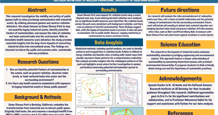
Zainab was part of the CalTeach program, working with Dosenet to create this poster using advanced gamma and neutron radiation detectors to measure radiation levels […]
Continue readingCategory Archives: Internship
DoseNet Summer 2024: Esther Luvishis’ Report
Radiation is used in a variety of medical procedures, so it’s not uncommon to see signs that warn of Radioactive Materials or that Caution for […]
Continue readingDoseNet Summer 2024: Dylan O’Dwyer’s Poster
Dylan worked with RadWatch to put together a poster for CalTeach.
Continue reading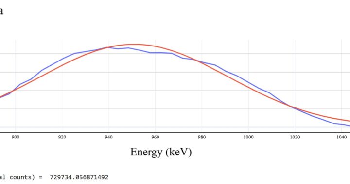
DoseNet Summer 2024: Justin Ely’s Report
The Berkeley DoseNet project utilizes Sodium iodide (NaI) scintillation detectors for gamma radiation detection. In order to obtain accurate measurement values with noise deduction applied, […]
Continue reading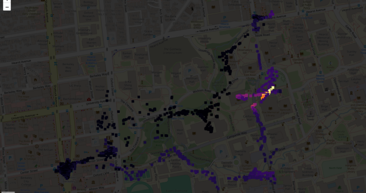
DoseNet Summer 2024: Kevin Wu, Aaron Ely, & Garry Li’s Report
Original mapping features on portable systems with D3S (CsI) detectors utilized dedicated Ultimate GPS modules; however, such modules were unreliable for mapping purposes as fixes […]
Continue reading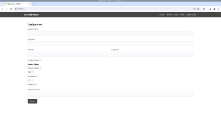
DoseNet Summer 2024: William Chen and Eddie (Zijian) Guo’s Report
This summer, we wrote a web interface (WebUI) server for DoseNet devices for the purpose of streamlining device setup on-premises, and to simplify the process […]
Continue reading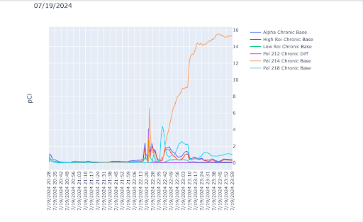
DoseNet Summer 2024: Aiden Wu’s Report
Ionizing radiation is a type of electromagnetic energy that, with enough exposure, can be harmful to organic life because it can damage DNA. We can […]
Continue reading
DoseNet Summer 2024: William Chen and Victor Luo’s Report
This summer, our team was focused on developing tools to interface with and collect data from the NaI (Sodium Iodide) Scintillation Detectors. We are using […]
Continue reading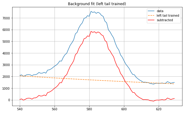
DoseNet Summer 2022: Akhilandeshwari Krishnan’s Report
Overview Akhilandeshwari Krishnan is a high school freshman newly working with DoseNet at UC Berkeley. His first project in Summer 2022 focused on spectral data […]
Continue reading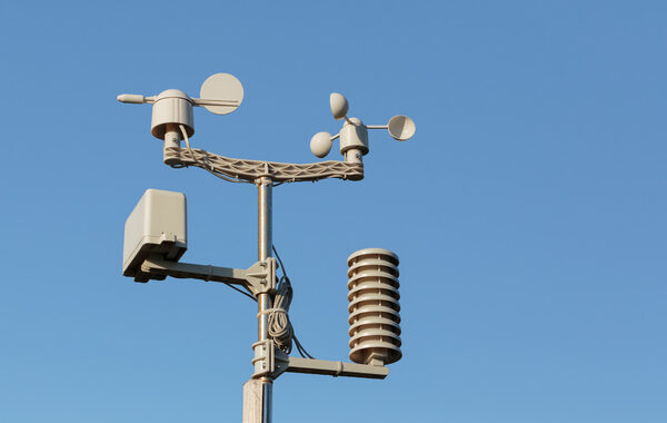
DoseNet Summer 2022: Vikram Gill’s Report
Introduction My work for the 2022 summer semester consisted of analyzing the accuracy of DoseNet’s sensors with comparisons to nearby sensors on the WeatherUnderground network. […]
Continue reading